Francisco Gutiérrez & Mateo Gutiérrez: LANDFORMS OF THE EARTH

Landforms of the Earth

An Illustrated Guide

Springer


Authors: Gutiérrez, Francisco, Gutiérrez, Mateo


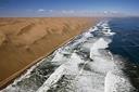
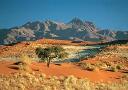
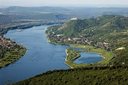
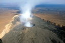
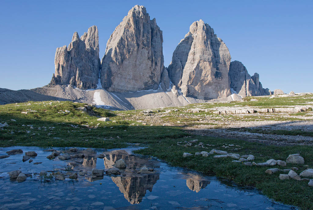
This is a highly illustrated book with each landform being described with the following structure: (1) Main characteristics, including geometric, morphometric and sedimentological features. (2) Genetic processes and controlling factors. (3) Different typologies if applicable. (4) Additional comments related to various relevant aspects such us environmental implications or geographical distribution. Image visualization of landforms is essential for learning geomorphology and stimulating the interest in this field-based subject; a picture is worth a thousand words. Consequently, the book constitutes a valuable educational resource for every university student enrolled in courses related with earth surface processes and landforms (e.g. Geomorphology, Physical Geography, Geology, Geohazards, Environmental Sciences.). The book is also attractive to travellers and people keen on nature who want to know about the terminology and origin of the landforms they encounter in their trips. In many cases, the geomorphological features constitute the main asset of first-class protected areas (e.g., UNESCO World Heritage Sites, National Parks).

Piotr Migoń (Ed.), Springer Book Series: WORLD GEOMORPHOLOGICAL LANDSCAPES

The new book series World Geomorphological Landscapes aims to be a scientific library of monographs that present and explain physical landscapes across the globe, focusing on both representative and uniquely spectacular examples. Each book contains details on geomorphology of a particular country or a geographically coherent region. The content is divided into two parts. Part one contains the necessary background about geology and tectonic framework, past and present climate, geographical regions, and long-term geomorphological history. The core of each book is however succinct presentation of key geomorphological localities (landscapes) and it is envisaged that the number of such studies will generally vary from 20 to 30. There is additional scope for discussing issues of geomorphological heritage and suggesting itineraries to visit the most important sites.


PUBLISHED TITLES IN THIS SERIES:


LL_P2

Landscapes and Landforms of PortugalVieira, Gonçalo, Zêzere, José Luís (Eds.)

LL_FR2

Landscapes and Landforms of FranceFort, Monique, André, Marie-Françoise (Eds.)

LL_S2

Landscapes and Landforms of SpainGutiérrez, Francisco, Gutiérrez, Mateo (Eds.)


LL_I2

Landscapes and Landforms of IndiaKale, Vishwas S. (Ed.)


LL_N2

Landscapes and Landforms of NamibiaGoudie, Andrew, Viles, Heather (Eds.)

LL_B2

Landscapes and Landforms of BrazilCarvalho Vieira, Bianca, Rodrigues Salgado, André Augusto, Cordeiro Santos, Leonardo José (Eds.)

LL_SA2


Landscapes and Landforms of South AfricaGrab, Stefan, Knight, Jasper (Eds.)


LL_H2

Landscapes and Landforms of HungaryLoczy, Dénes (Ed.)

LL_ET

Landscapes and Landforms of EthiopiaBilli, Paolo (Ed.)


dolomiti

Landscapes and Landforms of Italy – Soldati, Mauro, Marchetti, Mauro (Eds.)

LL_CO

Landscapes and Landforms of ColombiaHermelin, Michel (Ed.)


LL_CR2

Landscapes and Landformsof the Czech RepublicPánek, Tomáš, Hradecky, Jan (Eds.)


FORTHCOMING TITLES IN THIS SERIES:


Piotr Migoń, Heather A. Viles (Eds.), Sandstone Geomorphology – Landscape formation, field mapping, research methods, Zeitschrift für Geomorphologie, Supplementbände – Volume 59, 2015

In the series of Supplementary Issues of Zeitschrift für Geomorphologie a collection of papers arising from the conference Sandstone Landscapes III has just been published. The conference was co-organized by the Danxia Geomorphology Working Group and held in the Stołowe (Table) Mountains in SW Poland in April 2012. The volume contains 13 papers written by sandstone geomorphology specialists from Australia, China, the Czech Republic, and Poland. They cover a variety of specific subjects, including broader issues of rock control in sandstone terrains, overview of Danxia landscapes in China, rock slope stability, weathering processes and landforms, non-karst caves in sandstones, the origin of boulder accumulations, rock – soil – relief relationships, as well as the presentation of geomorphology of the conference area, i.e. the sandstone tableland of the Stołowe Mountains. Piotr Migoń (former co-chair of Danxia Geomorphology WG) and Heather Viles edited the volume. Abstracts (free) and full-texts (by subscription or to be purchased individually) can be accessed via
https://www.schweizerbart.de/papers/zfg_suppl/list#issue1

The full reference is: Sandstone Geomorphology. Landscape formation, field mapping, research methods. Eds.: Piotr Migoń; Heather A. Viles. Zeitschrift für Geomorphologie, vol. 59 (2015), Suppl. Issue 1, 268 pp.

Stories behind superlative scenery by Piotr Migoń

Geomorphology is part of Earth Sciences and is best described as the scientific study of landforms, their assemblages, and the processes that moulded them in the past and that continue to change them today. Geomorphologists study the shapes of landforms and the regularities of their spatial distribution; they decipher their origin and evolution, and try to establish their ages. Geomorphology has also been dubbed the ‘science of scenery’. Thus, the scenery – the combination of landforms and water – has become a subject of scientific inquiry.
Geomorphology is also about the interpretation of natural landscapes and, in the context of World Heritage properties, it helps us to understand what brought about their uniqueness and their rarity.

Read the whole paper published by World Heritage Review magazine published jointly by UNESCO and Publishing for Development (printed four times a year in English, French and Spanish). The publication presents and promotes the preservation of our World Heritage, with detailed feature articles and news items about the most outstanding cultural and natural sites in the world.

Mike J. Smith, Paolo Paron and James S. Griffiths (Eds.), Geomorphological Mapping. Methods and Applications. Developments in Earth Surface Processes, 2011, 15: 1-601

Geomorphological Mapping: a professional handbook of techniques and applications is a new book targeted at academics and practitioners who use, or wish to utilise, geomorphological mapping within their work. Synthesising for the first time an historical perspective to geomorphological mapping, field based and digital tools and techniques for mapping and an extensive array of case studies from academics and professionals active in the area. Those active in geomorphology, engineering geology, reinsurance, Environmental Impact Assessors, and allied areas, will find the text of immense value.

Read more … | … and more

Piotr Migoń (Ed.), Geomorphological Landscapes of the World. Springer, 2010

Physical landscapes are one of the most fascinating facets of our Planet, which tell stories about the evolution of the surface of the Earth. This book provides an up-to-date information about the geomorphology of the selected ‘classic’ sites from around the world and shows the variety of geomorphological landscapes as moulded by different sets of processes acting over different timescales, from millions of years to days. The volume is written by nearly fifty geomorphologists from more than twenty countries who for many years have researched some of the unique sceneries on the planet. The thirty six chapters present each continent of the world. They describe landscapes of different origin, so that the reader can learn about the complexity of processes behind the sceneries.

order now


Irasema Alcantara-Ayala and Andrew S. Goudie (Eds.) – Geomorphological Hazards and Disaster Prevention. Cambridge University Press, 2010

Human activities, especially in the last two centuries, have had a huge impact on the environment and landscape through industrialisation and land-use change, leading to climate change, deforestation, desertification, land degradation, and air and water pollution. These impacts are strongly linked to the occurrence of geomorphological hazards, such as floods, landslides, snow avalanches, soil erosion, and others. This book, with chapters written by an international team of geomorphologists provides state-of-the-art knowledge about the contribution of geomorphology to the comprehension of hazards, links the work undertaken by geomorphologists to the framework of the likely impacts of climatic change and global environmental change, shows the significance of technology (remote sensing and Geographical Information Systems) for hazard and risk assessment and management, and demonstrates the role of geomorphology in vulnerability and risk analysis, disaster prevention and sustainability.

Read more…


The Science of Scenery. How geomorphology can help Asia cope with its environmental challenges – by David Higgitt

Geomorphology can be regarded as the ‘Science of Scenery’. It seeks to explain how landscapes develop over time, the operation of earth surface processes such as erosion, landsliding and river flows, and the interactions between these processes and the landscape … The link between scientific research and environmental policy, however, is far from automatic. One of the key themes of the conference [Regional Conference on Geomorphology in Kota Kinabalu, 2007 – ed.] was ‘Communicating Geomorphology’, which explored how field scientists can integrate their research with a wider body of knowledge about the environment, discuss ideas with stakeholders and explain the significance of their research findings to a wider audience.

Read the whole paper published by ASIANGEOgraphic

1 2